Day 3 La Fleche to Loches 79 miles
Garmin file: http://connect.garmin.com/course/8245722 Elevation Gain: 1000m
Overview
Crossing the picturesque river at La Fleche we head out on the second longest day of the tour towards the Loire region and a noticeably easier ride elevation wise. The first ten miles are on some long straight roads through forests and woodland gently rising and falling. The rest of the morning seeus heading towards the impressive chateau at Langeais where we have lunch by the lazy Loire. The afternoon sees us passing even more chateaux and then you will start to notice interesting dwellings cut out of the rock as we enter the Troglodique valley of Groupillieres and follow the lovely river road there. After an afternoon cuppa there is a really nice run in to Loches that feels like you’re cycling slightly downhill for a long time.
Practical Notes
- The first few streets heading out in the morning are a bit fiddly as we go down no entry streets that are ok for us but can have cars coming towards you which can be a little disconcerting so take your time in the morning.
- The cycle path and some of the roads in the morning have potholes and some tree roots sticking up so please take care.
- There are cash machines in La Fleche and Noyant.
- Some of the roads leading up to lunch are a little bumpy.
- There is a r-bout right before lunch that it is safer to dismount at and walk a very short distance.
- At around 75 miles in just before Chanceaux-pres-Loches take care over the thick speed bumps
Map

Start point
At the front of the hotel at 8.30
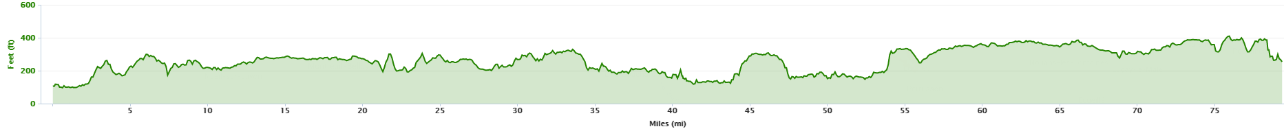
Elevation Profile
Lunch
Just after Langeais by the river Loire at 41 miles
Back up Lunch
Victor – Le Pont Levis – 8 Place Pierre de Brosse, 37130 Langeais, +33 2 47 96 82 23
Evening meal
We will aim for a rough time of 7:30 but whenever you are ready go L out of the hotel and you will see the restaurant on your R just before you meet the main road. La Farfalla,2 Place de la Marne,37600 Loches – 0033 2 47 59 01 66
Route Notes
Miles Route
0 From Relais Cicero go L out of the hotel (facing away from), further on the road bends round to the R, go L here taking care for traffic.
0.2 Come to a stop sign opposite Rue De College and go L then next R along the cobbled section down Rue du Marche au Bleu.
0.3 You will come to a crossroads at Grande Rue, go R here (No entry for cars but OK for bikes but still take extra care). At the statue of Henry the Fourth go L (also one way but OK for bikes) back the way you came in yesterday, continue straight down the road.
0.5 At the traffic lights, cross over the bridge, past the Town Hall, continue over the bridge and after a few hundred metres go L at Bar le Campuer at a no entry sign along Rue St Louis (ok for bikes).
0.9 At the crossroads at the end of Rue St Louis go straight over along Rue Sainte Colombe. Take care for potholes along here.
1.4 When you meet a busy road go straight over along Boulevard de la Petite Vitesse and then about 150 metres on you will notice the cycle path, go L on the cycle path along route 44 to Zoo de la Fleche.
1.5 Shortly after cross the busy road and then the path forks, keep R here to Zoo de la Fleche. Take care for tree roots along this section.
1.9 You will meet another road, cross straight over following signs to Zoo de la Fleche.
2.5 When you meet a stop sign at the D104 go L on the road, no longer following the cycle path to Sivegne s/s le Lude. Stay on this road.
4.7 You will reach a three pronged fork in the road, continue straight on here (middle road) along the D104A to Genneteil 10.
9.2 You will meet a crossroads, go straight over here along the D138 to Genneteil.
11.0 Come into Genneteil, keep R at the cenotaph and continue along the D198 to Deneze sous le Lude and Noyant. There are some public toilets here.
14.0 Come to the crossroads with the D79 and go R along the D79 to Auverse.
14.4 Carry on for about 400 metres, go past a crossroads and a farmhouse then go L along the D141 to Noyant. Stay on this road to Noyant.
18.0 Come to a T-junction in Noyant and go R and cycle up to a crossroads, go straight on here to Vernantes and Saumur.
18.1 Follow the road for about 100 metres and then just past the church go L. There is a cash machine here. There are public toilets at the back of the church.
18.3 At the r-bout just past the church go R (first exit). Look for the brew van here on your L.
18.8 Further on follow the road round to the R to Meon and La Pellerine along the D142.
19.5 Continue through Meon along the D142.
21.7 Come to a stop sign in La Pellerine and go L along the D62 to Rille, Breil and Parcay les P, then take the next R to Parcay les Pins along the D142.
24.4 Come to a stop sign in Parcay les Pins and go L (straight on) and continue through the village. Stay on this road.
28.1 Follow the road into the centre of Gizeux. Continue though the centre of the village along the D749 to Continvoir 2 & Langeais 21. There is a public toilet here a bit further along on your L.
Further along go straight on along the D15 to Continvoir & Langeais.
29.5 Continue through Continvoir and at the church go R to Les Essards & Langeais.
34.3 When you come into Les Essards follow the road round to Langeais.
34.6 On the other side of Les Essards come to a mini r-bout and go R to St Michel 6 and Ingrands 9.
35.2 A bit further along go L to St Michel 5 along the D125.
36.0 You will come into the small hamlet of Pont Boutard and take the 1st L. There are no road signs to mark this out (there is a Heineken sign on your R). Continue over a bridge and keep straight on. Stay on this road for 3 ½ miles. The road is a little bumpy along here.
39.8 As you approach Langeais you will come to a T-jcn. Go L to Centre Ville.
40.2 At the next T-jcn go R along Espace Joseph Lancelin.
40.6 You will come to a T-junction opposite the restaurant Le Pont Levis, go R here and then keep following the road round to the R and then just past a Creperie go L along the narrow Place du 8 Mai (there is an AXA insurance company on the R here).
40.7 At the end of this narrow lane go R and continue to the mini r-bout and at the r-bout go L under the rail bridge.
41.2 At the main road you will meet with the Loire. Go R to Saumur and continue to the bridge.
You will come to a R-bout at the bridge, we will be going L over the bridge here but first we will have lunch. To get to the lunch safely, go straight on at this r-bout and then cycle to the next R-bout, go all the way round this and then come back on the other side of the road and go R down to the river.
41.4 Leaving lunch go to the R-bou and go R over the bridge over the Loire and a few hundred metres after the bridge go L to Azay-le-Rideu & Chapelle aux Naux along the D16.
42.8 Come into Chapelle Aux Naux & turn R along Rue Principal at the ‘toilets’ sign. Continue past the church on your L. Stay on this road.
43.6 Go over a small bridge, come to a T-junction and go L .(there is a green cycle sign which points to the R). Stay on this road
44.1 The road rises to a small cross roads, go L here.
44.3 After a few hundred metres turn R at the small sign to La Godiniere along Levaleepicard.
44.6 Further along the road forks, keep L here
45.1 You will come to a T-junction, go R here.
45.4 Follow the road round to the L to Azay-le-Rideau. Further along the road descends.
47.7 The road descends to a T-junction at a stop sign. Go L to a mini-r-bout. And at the R-bout go R to le Chateau.
48.6 When you come to Azay-le-Rideau to need to follow the road round to the L to Centre Ville. Stay on this road through the town centre, there is a bike shop here.
48.8 When you come to the café & pizzeria Relais de la Salamandre keep R following the cycle sign to Loches 62.
25 metres on you will see the gates on your R to the chateau. The chateau was built between 1515 – 27 and is one of the earliest French Renaissance Chateaux.
48.9 Come to a r-bout and go straight over along the D84 to Artannes. Stay on this road for a few miles.
You will now be following the River Indre through The Troglodique Valley of Groupillieres which is also home to a number of interesting cave dwellings which were actually carved out in the middle age and onwards, not the stone age. The stone, called “Tufa” is made up of calcified organisms and is easy to carve, leading to the locals using it for all different purposes.
52.4 Just as you are leaving La Sabbloniere Turn R along the D356 to Sache 1.
52.9 Come to a T-junction and go L to Thilouze 5 along the D17.
53.6 At the bottom of a small dip go R to Thilouze 4 along the D19.
56.0 Come to a min r-bout in Thilouze and go straight on (L).
56.2 A few hundred metres on come to a stop sign and go straight over to Villeperdue 5.
59.0 Continue into Villperdue and follow the road round to the R and then take the L turn along the D21. Continue over the rail track and stay on this road.
60.0 Continue over the E5 and past a karting circuit.
60.8 Further along you’ll come to a junction at the main road. Cross straight over to Louans 6 continuing along the D21.
Take care for lorries along here
64.6 Follow the road through Louans. There are some nicer public toilets here just by the Marie on the R. Follow the road round to the L through the village. Stay on this road (D21).
67.4 Further along you will come to a cross roads with the D50. Cross over and continue along the D21 to St. Bauld 5 and Loches 22.
69.2 Follow the road round through Ste Bauld. The road bends sharp L to Loches 17 but you need to go R here, be careful not to miss this turn (there is a small sign on the R to Le Prieure & La Luziere). Keep straight on this narrow country lane.
70.3 Further along you will come to a cross road. Turn L.
70.6 Turn R along the D21 to Dolus le sec 3, Chambourg 9 & Loches 13 (the sign is facing away from you so you won’t notice it unless you look out for it when you actually turn).
72.4 Part way through Dolus-le-Sec go R immediately after the Marie along a narrow country lane, be careful not to miss this turn.
73.1 After about 500m you will come to a stop sign. Go R here.
74.8 Part way down a descent, out of nowhere you will go over a few ridiculous speed bumps, please make sure you are going very slow over these and if it is safe to do so, avoid them
75.0 Continue through Chanceaux-pres-Loches and continue to Loches.
77.8 After some time to will come to a crossroads with a large green building. Go L here.
78.1 At the r-bout go R to Loches 2. At the 2nd larger r-bout continue straight over.
78.5 You will see the Luccotel at the top of a hill on your L.
To get to the centre of town, the chateau, Hotel De France and Demure St. Ours
Continue past the Luccotel down the hill.
78.8 When you come to some traffic lights continue straight on to another set of lights. At the 2nd set of lights go R.
79.0 A bit further along turn L just before a small garage with a small basketball court on your L. This is Bigotteau St.
79.1 Go up a short steep rise and at the T-jcn go L to chateau along Port Poitevine St. Follow the road round to Centre Ville. Keep straight on and eventually you will go through the town centre and keep straight on until you reach the Hotel De France on your L.
To get to the Le Demure St Ours you need to turn R just before you reach the Hotel De France at a Pharmacie and an Orange shop on the corner. Go through the archway. On the other side of the archway the road bends round to the L but you need to go straight on then turn R and continue up the cobbled street. You will see a building on your L which says Acedemia with a small chambres d’hotes sign.
Hotel De France, 6 Rue Picois, 37600, Loches. 0033 2 47 59 00 32
Le Demure St Ours, 11 Rue Du Chateau, 37600, Loches. 0033 6 33 74 54 82
Luccotel, 14 Rue des Lezards, 37600, Loches. 0033 2 4791 30 30